As ubiquitous in our lives as the digital landscape of sites like Google Maps can be, they’re in some sense private space. They strip our world of human beings (or freeze them in strange, invasive shots taken by roving vans), and put that space in the exclusive hands of private publishers. (Or, at least, one beginning with the letter “g.”) That has helped the groundswell of interest in OpenStreetMaps as an alternative. But looking deeper, we’re reminded of our role in physical and imagined space and what mapping itself can mean.
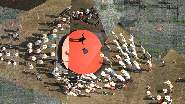
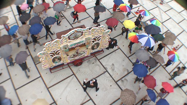
A film by Roel Wouters takes a creative approach to reimagining Google Maps, as crowds re-populate the area around Eindhoven’s Strijp S (the former industrial park in the Dutch city). Here, using overhead videography via fishing rods and tracking with orange traffic cones (“pylons”), the tiles in the map come to life with human movement. Crowds evoke the markers and overlays with fanciful movements in herds and miniature dances, drawing and scrawling and dancing across the surface of the map. The film calls pierces the veil between us and this constant, co-present virtual map of our world. It plays with the idea of maps as public space, and toys with the overhead perspective that soon becomes part of our self-conceptualization of our world.
It is a short film, a dance (complete with choreographer), a music video (complete with evocative, reflective score), an MGM color spectacular for the digital age.
Wouters may or may not have intended the political program, but the film for me re-humanizes the map. There’s no great arc to the film, no moment of revelation; it can become caught in its own technological ingenuity. But it still may have you seeing maps in different ways, and it demonstrates that tracking technology can be applied to radically different purposes in filmmaking.
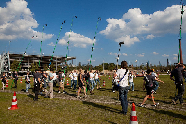
(Really, just a few cameras, orange cones, and fishing line – yes, you can do things like this.)
More details:
What if Google Maps went live…
was recorded using six cameras attached to fishing rods on the former Philips industrial site Strijp S in Eindhoven during flux/S SQUARE ONE, the Prelude September 3-4, 2011The crew with their fishing rod cameras:
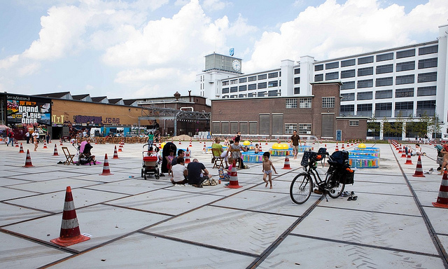
http://www.flickr.com/photos/roelwouters/6309115250/in/set-72157627740231879We used two thousand pylons as tracking markers:
http://www.flickr.com/photos/roelwouters/6309111936/in/set-72157627740231879/Check out more making-of photos here:
http://www.flickr.com/photos/roelwouters/sets/72157627740231879/with/6232198782/ [slideshow embedded below]Concept: Moniker commissioned by flux/S
Producer: Jan Schuijren – flux/S
Director: Roel Wouters – http://studiomoniker.comExecutive Producer: Vargo Bawits
On-Site Production: Marleen Hartjes
Communication: Maaike Delemarre
Pre-production: Chantal KleinmeulmanProduction Assistance: Eva Bullens, Eva van der Moer,
Walter van Beek, Jeanine des Bouvrie,
Henk van den Brink, Piet van BenthemPhotographer: Marc Faasse
Director of Photography: Sal Kroonenberg
Floor Manager: Eddy Stub
Camera Operators:Nicholas Burrough, Jeroen Simons, Edo Kuipers, Thijn Teeuwissen, Edwin Donders
Data Handler: Johan BosgraafChoreography: Katja Heitmann
Composer: Merlijn Twaalfhoven
Sound Recording:Friso Pas, Willem de Wijs, Peter van Suyderhoud
Audio Post-Production: Peter van Suyderhoud
Metronome sound: Rik Elstgeest
Post-Production: Shosho
Soundtrack Title Sequence: Guru by Light LightSpecial Appearances
Björn Ottenheim & Daan Schinkel – zZz
Luna Maurer / Moniker – Sand Pen
Karin de Wit – Hoola Hoop instructor
Roger Martinez – soundscape
Bas van Duren – speaker
Koninklijke Harmonie Phileutonia
Eindhovens Seniorenorkest
Stratums Muziekkorps St. Cecilia
Sambaband Batedeira
Escola de Samba os Malandros
Muziekvereniging Eindhoven West
Found via Rosa Menkman.
Behind the scenes images:


