53.0581° N, 9.5275° W from Lightscape on Vimeo.
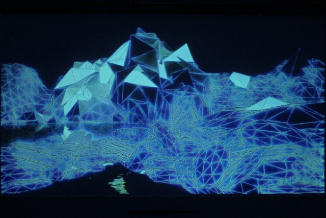
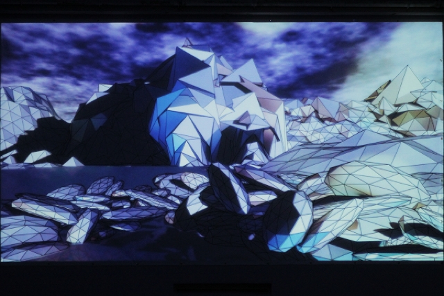
On a tiny island at the westernmost frontier of Europe, artists used projected light to bring a hand-drawn, geometric canvas to light. In an abstract reinterpretation of the island’s terrain, scrawled just before firing up the projectors, they produced an electrified virtual animated world. It’s a particularly compelling example of mapping, one in which the two-dimensional surface was enough to produce a three-dimensional illusion and immersive sensation.
Mike Murray writes CDM:
A group of people recently created a very beautiful piece of video mapping on a handdrawn canvas for a festival called Drop everything festival on Inis Oirr off the west coast of Ireland.
More specs and details:
The piece itself was mapped to a 5 x 3.5 meter line drawing which Lightscape began drawing on their arrival on the island.
Animation/Mapping : Anthony Murphy & Brian Kenny
Lighting Design/Production: Mick Murray
Audio by Isan, Antony Ryan & Robin Saville
Very special thanks to Scary Mary and the Drop Everything crew, the staff at Aras Eanna, Mick Durkan & Nine Yards, ISAN and everyone who attended.
Full description:
http://cargocollective.com/lightscape/53-0581-N-9-5275-W